
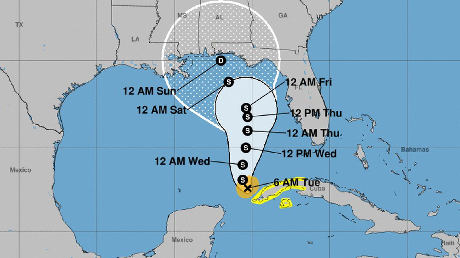
As of Tuesday, morning Tampa Bay is no longer in the cone of uncertainty when it comes to Tropical Storm Eta. And while forecasters don’t really know if it’ll strengthen as it moves slowly northwest in the Gulf of Mexico, WFTS’ BOTB-winning weatherman Denis Philips says, “squally weather is still possible later in the week.” Eta, Phillips added, “Still needs to be watched.”
For now, according to this Phillips Twitter graphic, Eta is expected to make landfall near the Florida-Alabama border early Friday morning.
ETA | The storm continues to move Southwest. Later Tuesday, it should stall and eventually move back North. While it's expected to remain offshore of the Bay Area, squally weather is still possible later in the week. Still needs to be watched. pic.twitter.com/uhrY1626QP
— Denis Phillips (@DenisPhillipsWx) November 10, 2020
Support local journalism in these crazy days. Our small but mighty team is working tirelessly to bring you up to the minute news on how Coronavirus is affecting Tampa and surrounding areas. Please consider making a one time or monthly donation to help support our staff. Every little bit helps.
Subscribe to our newsletter and follow @cl_tampabay on Twitter.
